
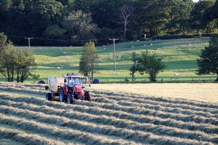
Photo Credit: Simon Pierce
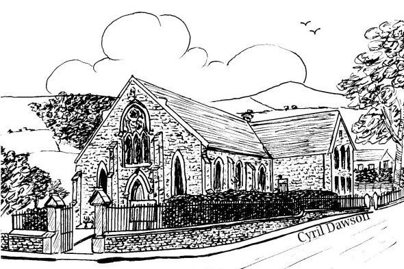
Langley Methodist Church
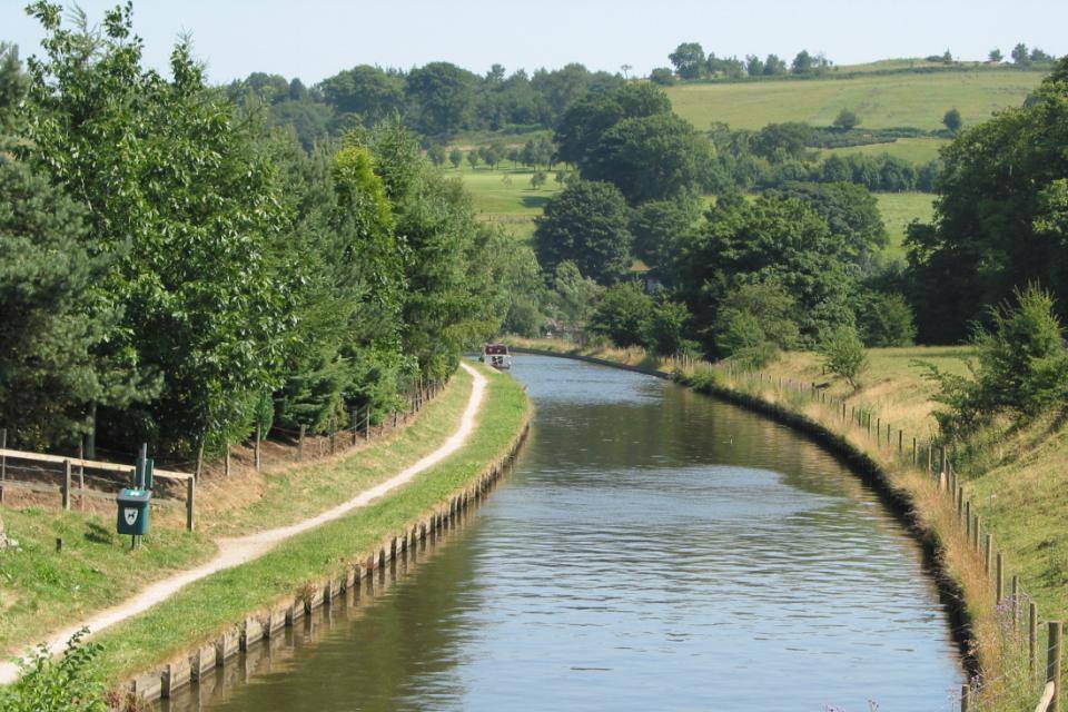
Macclesfield Canal
Photo Credit: Stephen Cavanagh
The Industrial Revolution had a profound impact on Sutton, especially the village of Langley. The availability of water for power and for the bleaching and dyeing processes led to the building of several mills between 1800 and 1875. These included the Bollinhead Mills in Holehouse Lane, the Albert Mill off Main Road and the Sutton Lane Ends Mill on Church Lane. By 1918, the firm of William Whiston had become the largest silk printing, dyeing and finishing company in the country; screen-printing was used for the first time in Britain at his Langley Print Works.
Macclesfield’s growing demand for building and paving stone led to the expansion of quarries such as those at Tegg’s Nose and Hawkshead. Its needs for drinking water led to the construction of a string of reservoirs including Ridgegate (1850) and Trentabank (1929). Another reservoir was constructed at Turkshead to feed the Macclesfield Canal which was opened in 1831. In 1826, the completion of the turnpike road from Macclesfield to Leek took coaching traffic away from the Leek Old Road and through Lyme Green and Oakgrove: the tollhouse at the end of Robin Lane was built to collect tolls from travellers using the new road.
The original manor house was replaced in the 16th Century by the current Sutton Hall (now a pub). Langley Hall (now converted to flats) was built around 1650.
Photo Credit: Stephen Cavanagh
AFTER THE NORMAN CONQUEST the Norman earls granted manors to individuals in return for certain duties. The recipient of the Manor of Sutton assumed the title ‘de Sutton’ and sometime in the Middle Ages the family built a hall to reflect their status. For centuries, little disturbed the tranquil farming communities in the area, although the locals received a shock in December 1745 when Bonnie Prince Charlie’s 6,000 strong Jacobite army passed along Leek Old Road heading for London.
Sutton (from Old English ‘Sudtone’ or South Town), was then a quiet township comprising of a number of settlements such as Blakelow, Gurnett, Jarman, Langley, Lyme Green, Oakgrove, Ridge Hill, Sutton Lane Ends and Symondley. Until the late 19th Century it extended towards Macclesfield along the current Byrons Lane and Mill Lane almost as far as Park Green.
Photo Credit: Stephen Cavanagh
The Lamb was built in the 1750s and in the 1780s the Poor House on Walker Lane was built to provide food, medical aid, clothing and money for the needy children of the township. Sutton St James’ Church and School, the Ex-Servicemen’s Club, Langley Chapel, the St Dunstan Inn and the Church House pub were all built between 1825 and 1890.
The industrialisation of the 19th century led to a rapid expansion of Sutton’s population, most noticeably at the northern end of the township where the expansion of Macclesfield’s silk industry meant the rapid development of housing. In 1894 Macclesfield’s municipal boundaries were redrawn and Sutton ‘lost’ its northern part which was absorbed into the Borough of Macclesfield. Sutton now ended at Gurnett Aqueduct as the new boundary followed the line of the canal. Some reminders of the ‘old’ Sutton remain, e.g. the industrial units between Gunco Lane and the railway are in what is now known as Sutton Garrison Business Park. With the boundary changes and the gradual decline of the silk industry in the 20th century, Sutton’s population dropped, from around 7,500 at the 1851 census to around 2,000 a century later.
The outbreak of two world wars in the last century claimed the lives of over forty men from the Parish. A local woman was also a victim – Florence Wallace Watson from Langley was amongst those who drowned when the ‘Lusitania’ was sunk by a U-boat in 1915. Since the Second World War, the Parish has become a desirable residential area and the population of the Parish has risen again. Sutton Lane Ends and Lyme Green saw considerable expansion in the twenty years after the war; in the late 1960s, the ‘Jarman estate’ was built on land belonging to Jarman Farm; and smaller developments such as Mill Fold (Langley) and the new housing south of Robin Lane later ensured that the Parish remains a thriving community.